Community patterns and traffic conditions in Cocke County are shaped by the interaction between regional travel, tourism activity, and local growth. Interstate 40 plays a central role in this system, carrying through-traffic, freight movement, and visitors traveling to and from nearby destinations. These overlapping demands place pressure on key corridors and interchanges, particularly during peak travel periods.
Understanding how traffic moves through the county, and how those patterns relate to community development, is essential for identifying practical and effective transportation solutions.
Traffic congestion in Cocke County is closely tied to tourism-related travel and the movement of vehicles along I-40. Seasonal surges, special events, and recreational travel can create bottlenecks at interchanges and along connecting roadways. These conditions affect not only visitors but also residents who rely on the same routes for daily travel, emergency access, and local commerce.
As traffic volumes increase, congestion can spill onto local roads that were not designed to handle high levels of through-traffic. This can reduce safety, increase travel times, and strain infrastructure intended primarily for local access.
Area of Study and Key Corridors
 Planning priorities identified for Cocke County highlight congestion, safety
 and the need to manage traffic associated with tourism and regional travel. As shown in the planning priorities slide, traffic challenges are not limited to a single roadway but are influenced by how multiple routes function together. Interstate access points play a key role in shaping traffic behavior.
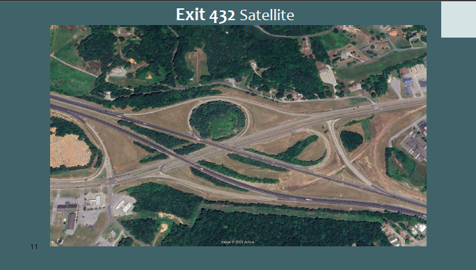
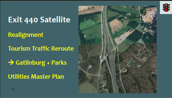
Interchange Areas and Localized Pressure
Planning graphics for Exit 432 and Exit 440 illustrate how traffic demand concentrates around specific interchange areas. These visuals show the relationship between interstate access, surrounding road connections, and areas with development potential.
At these locations, traffic associated with tourism and regional travel can spill onto local roads that were not designed to accommodate high volumes of through-traffic. This creates challenges related to safety, access, and long-term infrastructure performance. The examples demonstrate that while each interchange has unique characteristics, similar patterns occur across multiple locations in the county.
These interchange-focused graphics help explain why traffic issues must be addressed as part of a broader system rather than as isolated hotspots.
Corridor-Based Planning and Area of Study
The Area of Study and corridor map provides a broader view of how key routes function together across Cocke County. Rather than focusing on individual roads, this approach examines corridors as connected systems that carry traffic between interstates, communities, and regional destinations.
The map shows the primary corridors used to evaluate traffic movement, connectivity, and potential rerouting opportunities. By understanding how traffic is distributed across these corridors, planners can better identify where improvements may reduce congestion, improve safety, or support more efficient travel patterns.
This corridor-based approach supports coordinated planning and helps anticipate how changes in one part of the network may affect conditions elsewhere.


